 Santuario Chiquito
A conservation contribution is not a purchase of land.
The conservation contribution is a contribution intended to fund conservation actions. It does not constitute ownership, possession, dominion, usufruct or any real right over the territory, property, ecosystem, natural resource or associated individual. This wording is subject to review by legal counsel before it is considered a final contractual clause. See also the legal notice on Conservation Vouchers.
What is Santuario Chiquito?
Santuario Chiquito began as a family effort on the main Santuario farm (40 ha) and the Finca Santa Lucía (40 ha). Over time, we have managed to inspire and involve the local community, consolidating a territorial process of community governance that brings together small and large rural landowners to show that protecting the ecosystem and sustainable tourism are economically viable.
The territory is not just a tourist destination: it is a territory of high environmental value where nature tourism is used as a tool to generate resources for conservation. Here the páramo, the forest, the water and the biodiversity are protected, through restoration, patrolling, maintenance, monitoring, environmental education and control of gorse (retamo espinoso).
The territory: 3 ecosystems protected together
The goal is to reach 650 hectares dedicated 100% to conservation. Today, 350 hectares are already under direct custody and strict conservation; another 140 hectares are in the formal process of joining (Finca La Hoya, Laguna Seca, Las Tapias) and 160 hectares are projected to the south of Santuario Chiquito (Vereda El Bosque, Pacho). They will be brought in progressively through resources from ecotourism, sustainable sports events and Conservation Vouchers.
Explore the territory’s interactive map, layer by layer →
Páramo de Guerrero
The territory is part of the Corredor Guerrero (Pacho–Tausa–Cogua–Zipaquirá) and sits on the continental water divide between Pacho and Tausa. It protects 7 species of frailejón, 3 of them Critically Endangered (CR), and broad stretches of native bunchgrass.
High-Andean forest
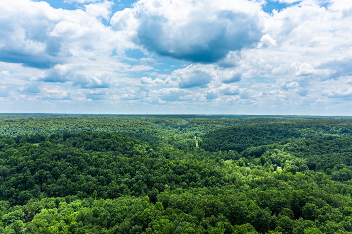
Active restoration, with more than 2,000 native trees planted along water margins, 8 ha cleared of gorse (retamo espinoso, an invasive species), 4 ha in natural regeneration (≈10,000 potential trees) and 4 ha of a pilot productive restoration with chocho de monte.

Water and biodiversity
The territory supplies 2 large watersheds (Río Bogotá and Río Negro), with 4.2 km of protected water margins and 7 bodies of water and springs conserved. They are the foundation that all of the territory’s biodiversity depends on.
The territory map, layer by layer
Turn layers on or off to see each ecosystem and each conservation action separately. Tap a polygon to see its details. The polygons come from the team’s real surveys. A polygon is territorial information for traceability, not a plot for sale or a title to land. See the actions each layer sustains →
Ecosystems
Conservation actions
Conservation units as a layer of their own: to be defined. Today each territorial unit matches the layers above; it will be split into its own layer once distinct subdivisions exist.
Loading the map…
Browse by list
An alternative to the map, useful on small screens or if you prefer to read before tapping the map. Tap any zone to see its details above.
Loading zones…
Mapped on this map
Real area of the polygons you can switch on above, calculated directly from the files supplied by the team. It is not a projection. It is not added to the figures for the full program higher up this page, to avoid counting the same territory twice.
Species this territory protects and monitors
The territory is part of the Corredor Guerrero, a protected and monitored habitat for umbrella species, and one that universities study directly. These are some of the territory’s verified species, with none singled out above the rest.
A páramo canid with a restricted range in Colombia, an umbrella species monitored within the territorial network.
Umbrella species monitored within the Corredor Guerrero.
Protected wild cat, with its habitat monitored in the territorial network.
Umbrella species of the Pacho–Tausa–Cogua–Zipaquirá corridor.
Páramo bird of prey, an indicator of the health of the open ecosystem.
Páramo hummingbird, an umbrella species monitored in the corridor.
Amphibian under active monitoring, associated with the territory’s bodies of water.
Endemic to the Páramo de Guerrero and listed as Critically Endangered (CR); one of 7 species of frailejón protected in the territory.
Studied by the Universidad de los Andes and the Universidad Militar Nueva Granada for how they compete with commercial apiaries.
The territory also protects 6 other species of frailejón (Espeletia chocontana, also Critically Endangered, along with E. grandiflora, E. corymbosa, E. boyacensis and E. argentea), 2 species of puya (Puya trianae and Puya boyacana), cuy, runcho, opossum, andean guan (pava de monte), sickle-winged guan (pava maraquera) and páramo pollinator flies. A full profile of each one is in the matching vouchers in the Conservation Shop.
Productive conservation: how your visit becomes protected territory
Santuario Chiquito connects nature tourism with payments for environmental services (PES) that sustain the peasant and protector families of the territory.
You book a hike or buy a Conservation Voucher.
Your conservation contribution is recorded, along with the value of the tourism.
Hikes, mountain events and partnerships generate steady activity in the territory.
The resources each mechanism generates go directly to the territory.
Restoration, patrolling, monitoring, water and biodiversity.
Public figures of the model
These are the same 4 categories that organize the Conservation Shop, so the same language carries from the individual voucher to the full explanation of the model.
More detail, in your own terms
The reserve is organized as a territorial network in which different landowners take part. Each property can have a different size, and conservation is tied to the protected area within each one.
The valuation and management of the conservation areas take into account the characteristics and conditions of each area: environmental, ecosystem, water and connectivity factors within the territory.
There is a logic of recognition and payment for conservation: the resources generated by tourism, Conservation Vouchers, partnerships, payments for environmental services (PES) and other mechanisms can feed this model and help sustain the conservation of the territory.
The model is sustained by several mechanisms: nature tourism (hikes and experiences), mountain events, Conservation Vouchers and partnerships with companies and agencies. The resources each one generates go to caring for the páramo and the high-Andean forest, protecting water and biodiversity, restoration, gorse (retamo espinoso) control, monitoring, maintenance, patrolling and environmental education.
Follow-up is done in the field, with direct verification by the reserve team of the hectares and species protected or restored within the network that sustains this model: 350 hectares already consolidated today, on the way to the goal of 650 hectares dedicated 100% to conservation.
Every conservation action is recorded with its type, the exact territorial unit where it takes place and its status. The level of evidence available (photo, date, document) depends on each action. Today the team is organizing that photo record; as it is uploaded, it will appear directly on each zone’s details in the interactive map above. Evidence that does not exist yet is never shown.
Individual vouchers directly fund the management of the territory: local (“baquiano”) guides, restoration days and threat control. Corporate contributions are channeled through APPPA (Asociación de Productores y Protectores de Páramo y Agua), the nonprofit organization that issues the donation certificate (see Companies — B2B vouchers).
Santuario Chiquito is part of two upper river basins, and within them it directly protects several smaller watersheds.
Upper Río Bogotá Basin: the Río Neusa, the Quebrada El Mortiño and the Quebrada El Santuario.
Upper Río Negro Basin: the Río Yayatá (the direct source of the Río Negro) (3.0 km), the Río Patasía and the Río Guayoque.
The protected water margins add up to 4.2 km: besides the Río Yayatá, they include the Quebrada El Santuario (600 m), the Quebrada El Mortiño (300 m) and the Quebrada El Chochal (300 m). The 7 bodies of water conserved are Laguna El Chochal, Laguna El Santuario, Laguna Colorada, Pozo de Los Veras, Laguna Las Lamas, Laguna Seca and the water complex of 4 lakes at Las Tapias.
Protecting these small watersheds, with their streamside vegetation, their water margins and the páramo that feeds them, is one of the central reasons Santuario Chiquito’s conservation model exists. Learn about the Water Conservation Voucher →
A former coal mine, abandoned after the environmental authority suspended it, was fully recovered: 5 tons of mining and industrial waste were removed. By showing the landowner the value of nature tourism, a productive conversion was achieved. He cleaned up the land, allowed passive restoration and invested in a container shelter that now serves as a base camp for scientific tourism and hikers.
In addition, 200 kg of ordinary solid waste have been removed in community volunteer days along roads and telecommunications areas. That is why, on the interactive map, this layer is called “Environmental cleanup” and not just “mining waste”: it covers the 2 real sources of waste in the territory, not only the mine’s historical liability.
An informal network of territory guardians was created: peasant farmers and local landowners who watch over the páramo, report poaching and the illegal extraction of straw or timber, and keep domestic animals out.
More than 5,000 people have learned about the territory over 10 years, through interpretive hikes focused on active conservation, water issues and the recovery of the territory’s ancestral Muisca memory.
- It is not, in general, a purchase of property in the territory.
- It is not a certified offset, unless specific technical and legal support says otherwise.
- It is not an official environmental certificate.